|
|


Routing Control - ASL Compliance |

|

|
|
Routing Control - ASL Compliance |
|
|
|
|
Routing Control - ASL Compliance |
|
|
|
Routing Control - ASL Compliance |
|
|
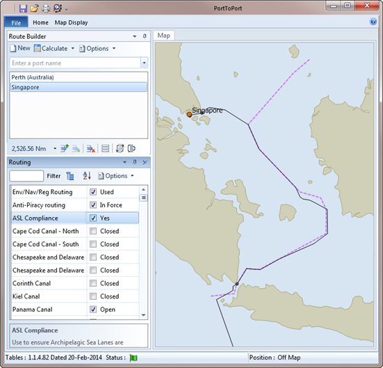
The ASL Compliance routing option when enabled will restrict routes through Indonesian waters to those that follow the recommended Archipelagic Sea Lanes. The display of these can be controlled with the appropriate check box in the Marine Information section of the Home Ribbon Tab.
The lanes are 50 Nm wide and the displayed lines mark the centre line, not a recommended route, hence the deviation from the ASL line in the first screen shot to shorten the route and avoid areas of shallower water.
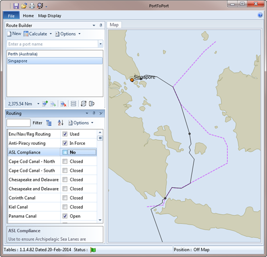
In the following example, with the ASL Compliance option disabled, a route through Selat Gelasha is used. For the purposes of this example, a route through the Sunda Strait has been used, a shorter route is available by allowing the route to use the Lombok Strait.
|
|