|
|


Routing Control - Env/Nav/Reg Routing |

|

|
|
Routing Control - Env/Nav/Reg Routing |
|
|
|
|
Routing Control - Env/Nav/Reg Routing |
|
|
|
Routing Control - Env/Nav/Reg Routing |
|
|
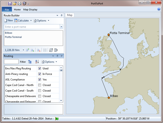
With this option enabled, calculated routes will take account of the potential for Environmental Risk, Navigational and Regulatory requirements.
Environmental Risk applies a weighting on some areas to favour others. For example, a slightly longer route may be preferred over a narrow passage, possibly with strong tides or one which may pass close to environmentally sensitive coral reefs.
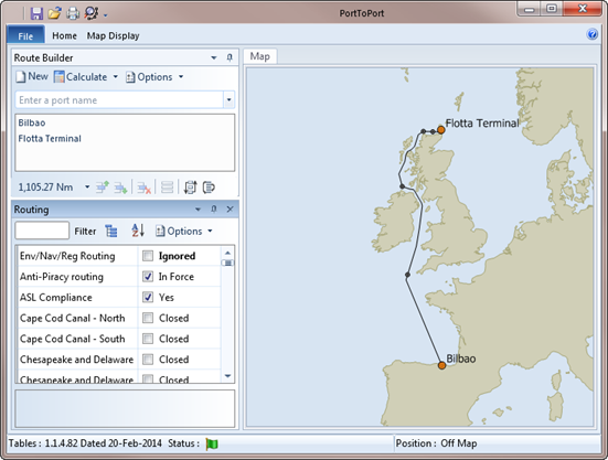
One such example is the Pentland Firth between Scotland and the Orkney Islands. A route between Bilbao and Flotta calculated with the Environmental Routing (Env/Nav/Reg Routing) option enabled, routes through the Dover Strait and North Sea giving a distance of 1228 Nm.
Disabling the Env/Nav/Reg Routing option produces a shorter route with a distance of 1105 Nm but takes a route through the North Channel, West of Scotland and through the Pentland Firth.
|
|