Route Scanning |

|

|
|
Route Scanning |
|
|
Route Scanning |
|
|
|
Route Scanning |
|
|
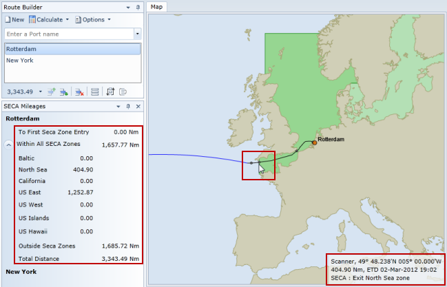
Route Scanning involves the software examining a route and calculating the locations at which it enters or exits certain areas. These currently consist of Emission Control Areas, Loadline and Marpol Zones, and the Indian Ocean Piracy area.
The areas to be included within the scan and when the scanning process occurs is controlled by the options on the Map Overlays and Zone Scanning Ribbon Tab dedicated to this aspect of the software.
When a route is scanned against an area, waypoints are inserted into the route at the boundaries of those areas, thereby allowing the distance to and ETA at that location to be established.
In the case of Emission Control Areas, the software specifically identifies the distance to the first entry into an area and the distances within each area. These are available for each leg of the voyage and in total for the entire voyage.
The following screen shot illustrates a route from Rotterdam to New York scanned for Emission Control Areas showing the waypoint at 5°0' W where the route exits the North Sea zone. The mileage to that location (and total mileages within Emission Control Areas) are displayed in the ECA Mileages dockable window on the left of the screenshot and is also displayed in the waypoint information in the bottom right corner of the map. This also includes the ETA at that location.